
You can idle around a new lake for an hour trying to find the break, or you can already know it's there before you back the trailer down the ramp. The gap between those two mornings is usually just information — the same information a guide or a 30-year local already has in their head. Contour Maps put that in your hands instead. Pull it up on the couch the night before, or offline at the landing when there's no signal.
What It Does
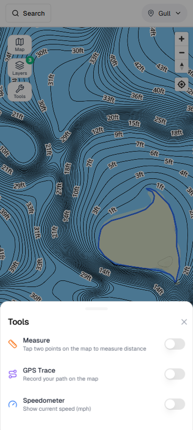
Fish Guide Pro's Contour Map gives you detailed bathymetric maps of Minnesota lakes so you can see underwater structure at a glance — main-lake humps, mid-depth breaks, rocky points, weed-flat edges — without idling around for hours to find them yourself. Contour lines reveal where fish stage during seasonal transitions; sharper breaks generally mean better potential. Filter by depth to isolate the 15–30 ft zone where summer walleye suspend, or find the shallow rock flats that warm first in spring.
Pro subscribers unlock 1-foot contour resolution derived from DNR raster data — a real step up from the 5-foot lines on the free plan. And because the maps work offline, you're covered even where there's no cell signal.
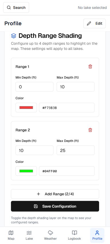
Depth Shading builds on the same data: overlay a customizable color gradient on the lake bottom so you can isolate depth zones visually instead of reading contour lines. Set your own ranges and colors to match the species and season — shade the 8–14 ft breakline for spring crappie, or the 20–35 ft basin for suspended summer walleye. Your configuration carries across every lake in the app.
Best used for
- ✓ Finding mid-lake humps and sunken islands for suspended walleye
- ✓ Locating sharp breaks for post-spawn staging
- ✓ Identifying shallow rock flats that warm early in spring
- ✓ Pinpointing weed-flat edges for largemouth bass
- ✓ Scouting a brand-new lake before the first trip of the season
- ✓ Isolating a depth band with Depth Shading so structure jumps off the screen without reading contour lines