A lifelong local doesn't know a lake because of one good trip — they know it because of ten years of pins in their head: the hump that always holds fish in June, the spot that produced last October, the drop-off nobody else fishes. Most anglers lose that knowledge to memory. Waypoints and Catch Log exist so you don't have to.
What It Does
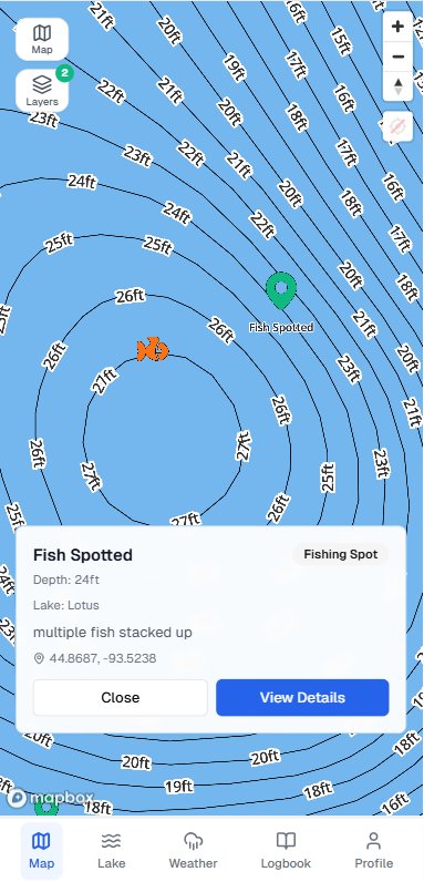
Waypoints let you drop pins on productive spots, hazards, access points, and landmarks right on the lake map. Categorize each one — Fishing Spot, Structure, Hazard, or Landmark — and add depth and notes so you remember exactly why you marked it. Free accounts get 10 waypoints; Pro is unlimited, and everything syncs across devices so you never lose a spot.
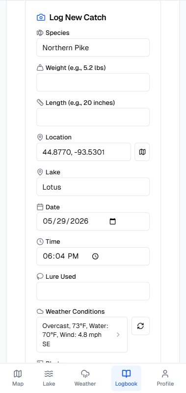
Catch Log turns every fish you land into data you can actually use later. Log species, weight, length, GPS location, and a photo at the moment of the catch — Fish Guide Pro automatically captures a weather snapshot (air temp, water temp, wind, sky conditions) alongside it, so you can replay exactly what was happening when the fish bit. Over a season or two, your own catch history starts revealing patterns generic advice never could: which depth produced in late October, which moon phase loaded up the crappie, which spot kept producing year after year.
Best used for
- ✓ Marking a hump you found on the contour map so you can find it again fast
- ✓ Saving a productive dock or weed pocket for future trips
- ✓ Flagging hazards like rocks and stumps for safe navigation
- ✓ Logging a personal best with a photo and exact location
- ✓ Reviewing last year's catches on a lake before you return in the same season
- ✓ Comparing catch conditions across trips to spot what actually predicts a good day